 |
 |
New KRAG Map Icons: |
| Author | Message |
|
calumma Senior Member Joined: 27 Jun 2003 No. of posts: 351 View other posts by calumma |
Posted: 15 Jul 2009 As everyone is probably aware, KRAG is the data holder for herpetofauna records in Kent. To date we have over 21,000 records on our system. What you may not be aware of is that KRAG can now provide digital data as part of a standard search request. This data is output as a kml file and can be viewed in Google Earth (or any other compatible GIS software). We have recently commissioned Jen Drage from Aye-Aye Design to create new icons for use with this digital data. These icons are now complete and really do bring the digital maps alive! Image reduced in size to save bandwidth. The above image illustrates records at one of KRAG's Key Amphibian Sites (Ham Street Woods NNR). Each of the icons represents an individual record and can be clicked in Google Earth to reveal further information. The numbers used to label this information correspond to the record's unique id and can be used to look up more details in a list that is provided as a pdf. If a grid reference is supplied as part of the record search, the record list will also reveal the distance and direction from the point of interest to each available record. The icons of older records appear more transparent, so as to highlight the most recent observations. I am also considering further manipulating the icons to better represent other meta-data (such as grid reference precision). All searches are of course completely free of charge to local recorders and conservation land managers and we hope that by developing ways to more clearly present results we will help folks to better interpret data for the sites where they record. Commercial users can also request the same digital data and more information for such folks is available on the KRAG website. If you are interesting in seeing the icons in action PM me and I will send you an example data file. If you have suggestions for how any aspects of KRAG's data searches can be improved, please don't hesitate to provide feedback. Lee Brady Kent Herpetofauna Recorder | Independent Ecological Consultant |
|
Vicar Senior Member Joined: 02 Sep 2004 No. of posts: 1181 View other posts by Vicar |
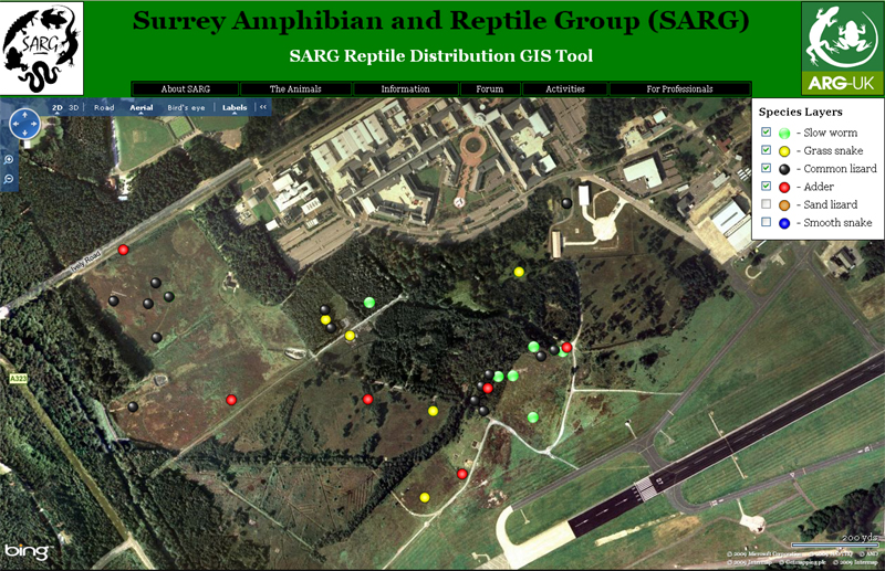
Posted: 16 Jul 2009 Hi Lee, Interesting approach. One of the design criteria I specified was that icons should be as small as possible, whilst being clearly visible at all zoom-levels. Our core sites have many hundreds of records, and large icons led to overcrowding of the screen, and an inability to clearly discern useful information. Filtering by year, species or whatever can help this, and has led to the development of species 'layers', where you can look at a sub-set of all species by simply clicking a tick box. The requirement for small icons drove me to a colour-coded route, but shading is important (for the colour sight challenged), and for contrast against a variety of map and aerial images. Here's a screenshot of where I'm at currently.  1 brownie-point if you know the location  Steve Langham - Chairman 
Surrey Amphibian & Reptile Group (SARG). |
|
GemmaJF Admin Group Joined: 25 Jan 2003 No. of posts: 2090 View other posts by GemmaJF |
Posted: 16 Jul 2009 That would be Farnborough Steve  Gemma Fairchild, Independent Ecological Consultant |
|
calumma Senior Member Joined: 27 Jun 2003 No. of posts: 351 View other posts by calumma |
Posted: 16 Jul 2009 Steve Being colour blind means that colour coded maps often mean very little to me 
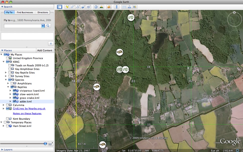
The icons we have commissioned are intended for volunteers (and consultants I guess) and are meant to add a little 'jazz' to the data. They are not suitable for all situations. We can present the icons at different sizes and of course use different symbols for different purposes. It shouldn't come as a surprise that I prefer black and white symbols when producing material designed to be more rigorously interpreted (or printed). The KRAG data can also be viewed across different layers so that individual species information can be pulled out. See the screen grab below that illustrates just the reptiles at Ham Street (image reduced in size): 
Using Google Maps I am also encouraging individual recorders to draw boundaries around their recording 'sites'. These boundaries are also then available in Google Earth and species data can be plotted as required. We have also asked Jen to design some standard 'habitat feature' icons such as ponds, hibernacula, log piles etc. We hope that recorders will then plot such features on their site maps so that we can make the information available to those organisations involved in site management work. I'd certainly get brownie points if I took the kids to one of the airshows! Lee Brady Kent Herpetofauna Recorder | Independent Ecological Consultant |
|
calumma Senior Member Joined: 27 Jun 2003 No. of posts: 351 View other posts by calumma |
Posted: 16 Jul 2009 Looks like Gemma got in before me while I was gassing on the phone! Lee Brady Kent Herpetofauna Recorder | Independent Ecological Consultant |
- New KRAG Map Icons |